Naver, Daum, Google Open API
글 수 52

cyber
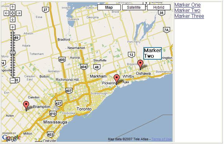
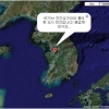
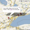
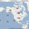
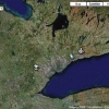
http://www.subkorea.com/api/google/MapsAPI/marker-maptips3.html별도의 링크 텍스트 (마크 오버시 설명, 2의 개선안 - xml)
<!DOCTYPE html PUBLIC "-//W3C//DTD XHTML 1.0 Strict//EN" "http://www.w3.org/TR/xhtml1/DTD/xhtml1-strict.dtd">
<html xmlns="http://www.w3.org/1999/xhtml">
<head>
<title>Google Maps</title>
<script src="http://maps.google.com/maps?file=api&v=2&key=abc...xyz" type="text/javascript"></script>
<!-- ============== create a style for the tooltip ============ -->
<style type="text/css">
.tooltip {
background-color:#ffffff;
font-weight:bold;
border:2px #006699 solid;
}
</style>
</head>
<body onunload="GUnload()">
<!-- you can use tables or divs for the overall layout -->
<table border=1>
<tr>
<td>
<div id="map" style="width: 550px; height: 450px"></div>
</td>
<td width = 150 valign="top" style="text-decoration: underline; color: #4444ff;">
<div id="side_bar"></div>
</td>
</tr>
</table>
<a href="tooltips4.htm">Back to the tutorial page</a>
<noscript><b>JavaScript must be enabled in order for you to use Google Maps.</b>
However, it seems JavaScript is either disabled or not supported by your browser.
To view Google Maps, enable JavaScript by changing your browser options, and then
try again.
</noscript>
<script type="text/javascript">
//<![CDATA[
if (GBrowserIsCompatible()) {
var side_bar_html = "";
var gmarkers = [];
var htmls = [];
var i = 0;
// A function to create the marker and set up the event window
function createMarker(point,name,html) {
var marker = new GMarker(point);
// === store the name so that the tooltip function can use it ===
marker.tooltip = '<div class="tooltip"><nobr>'+name+'</nobr></div>';
GEvent.addListener(marker, "click", function() {
marker.openInfoWindowHtml(html);
});
gmarkers[i] = marker;
htmls[i] = html;
side_bar_html += '<a href="javascript:myclick(' + i + ')" onmouseover="mymouseover('+i+')" onmouseout="mymouseout()">' + name + '</a><br>';
i++;
map.addOverlay(marker);
// ====== The new marker "mouseover" and "mouseout" listeners ======
GEvent.addListener(marker,"mouseover", function() {
showTooltip(marker);
});
GEvent.addListener(marker,"mouseout", function() {
tooltip.style.visibility="hidden"
});
}
// ====== This function displays the tooltip ======
// it can be called from an icon mousover or a side_bar mouseover
function showTooltip(marker) {
tooltip.innerHTML = marker.tooltip;
var point=map.getCurrentMapType().getProjection().fromLatLngToPixel(map.fromDivPixelToLatLng(new GPoint(0,0),true),map.getZoom());
var offset=map.getCurrentMapType().getProjection().fromLatLngToPixel(marker.getPoint(),map.getZoom());
var anchor=marker.getIcon().iconAnchor;
var width=marker.getIcon().iconSize.width;
var height=tooltip.clientHeight;
var pos = new GControlPosition(G_ANCHOR_TOP_LEFT, new GSize(offset.x - point.x - anchor.x + width, offset.y - point.y -anchor.y -height));
pos.apply(tooltip);
tooltip.style.visibility="visible";
}
// ===== This function is invoked when the mouse goes over an entry in the side_bar =====
// It launches the tooltip on the icon
function mymouseover(i) {
showTooltip(gmarkers[i])
}
// ===== This function is invoked when the mouse leaves an entry in the side_bar =====
// It hides the tooltip
function mymouseout() {
tooltip.style.visibility="hidden";
}
// This function picks up the side_bar click and opens the corresponding info window
function myclick(i) {
gmarkers[i].openInfoWindowHtml(htmls[i]);
}
// create the map
var map = new GMap2(document.getElementById("map"));
map.addControl(new GLargeMapControl());
map.addControl(new GMapTypeControl());
map.setCenter(new GLatLng(43.907787,-79.359741), 9);
// ====== set up marker mouseover tooltip div ======
var tooltip = document.createElement("div");
map.getPane(G_MAP_FLOAT_PANE).appendChild(tooltip);
tooltip.style.visibility="hidden";
// Read the data from example.xml
var request = GXmlHttp.create();
request.open("GET", "example.xml", true);
request.onreadystatechange = function() {
if (request.readyState == 4) {
var xmlDoc = GXml.parse(request.responseText);
// obtain the array of markers and loop through it
var markers = xmlDoc.documentElement.getElementsByTagName("marker");
for (var i = 0; i < markers.length; i++) {
// obtain the attribues of each marker
var lat = parseFloat(markers[i].getAttribute("lat"));
var lng = parseFloat(markers[i].getAttribute("lng"));
var point = new GLatLng(lat,lng);
var html = markers[i].getAttribute("html");
var label = markers[i].getAttribute("label");
// create the marker
var marker = createMarker(point,label,html);
}
// put the assembled side_bar_html contents into the side_bar div
document.getElementById("side_bar").innerHTML = side_bar_html;
}
}
request.send(null);
}
else {
alert("Sorry, the Google Maps API is not compatible with this browser");
}
// This Javascript is based on code provided by the
// Blackpool Community Church Javascript Team
// http://www.commchurch.freeserve.co.uk/
// http://econym.googlepages.com/index.htm
//]]>
</script>
</body>
</html>
http://subkorea.com/xe/84627
(*.225.54.140)
|
||||||||||||||||||||||||||||||||||||||||||||||||||||||||||||||||||||||||||||||||||||||||||||||||||||||||||||||||||||||||||||||||||||||||||||||||||||||||||||||||||||||||||||||||||